Copyright
Acknowledgements
Disclaimer
Terms & Conditions
Sitemap
Advertisers
Contact Us
Navigation information current to 16 June 2014
Reading the maps
Legend
Navigation information
Map Index
Smooth and partially smooth water limits
Keppel Bay and Port Alma
Gladstone
Seventeen Seventy
Hervey Bay
Maryborough
Northern Moreton Bay
Southern Moreton Bay
Capricorn Coast
Gladstone
Discovery Coast
Hervey Bay
Great Sandy Strait
Noosa River
Sunshine Coast
Pumicestone Passage
Moreton Bay
Southern Moreton Bay
Brisbane River and Bremer River
Northern Gold Coast
Southern Gold Coast
Boating Safety Information
Collision regulations
Navigation lights
Speed limits
Diving operations
Boat wash
Alcohol limits
Lifejackets and personal flotation devices
Distress signals, flares and EPIRBs
Required Safety Gear in Queensland
Boating Safety Stickers
Queensland Boating Capacity Label
Powered Boats with flybridges
Powered vessels 6 metres or more
Powered vessels less than 6 metres
PWC / Jet ski RideSmart Label
Lifejackets sticker (red over white)
Lifejackets sticker (white over red)
First Aid Kit sticker
Fire Extinguisher sticker
Nautical Flags sticker
27MHz Marine Radio Sticker Pack
VHF Marine Radio Sticker Pack
Safety Equipment Sticker Pack
No Smoking sticker
Smoking Area sticker
50:1 Fuel to Oil Ratio sticker
100:1 Fuel to Oil Ratio sticker
Navigation Markers sticker
How to use a VHF marine radio
Volunteer Marine Rescue Organisations
Yeppoon (Rosslyn Bay)
Gladstone
Seventeen Seventy (Round Hill Head)
Bundaberg (Burnett Heads)
Hervey Bay (Urangan)
Wide Bay Bar (Elbow Point)
Noosa Head
Mooloolaba
Caloundra Head
Bribie Island (Bongaree)
Tangalooma Point
Brisbane Bar
Gold Coast Seaway
Tweed Heads
Rain Radars
Gladstone
Gympie (Mt Kanigan)
Brisbane (Mt Stapylton)
Satellite Images
Synoptic Chart
Coastal Waters Forecast
Capricornia Coastal Waters Forecast: St Lawrence to Burnett Heads
Hervey Bay Waters Forecast
Fraser Island Coastal Waters Forecast: Sandy Cape to Double Island Point
Sunshine Coast Waters Forecast: Double Island Point to Cape Moreton
Moreton Bay Forecast
Gold Coast Waters Forecast: Cape Moreton to Point Danger
Current Warnings for Queensland
Round Hill Creek
Wide Bay Bar
Noosa Bar
Maroochy Bar
Mooloolah River mouth
Caloundra Bar
South Passage Bar
Jumpinpin Bar
Gold Coast Seaway
Tallebudgera Bar
Currumbin Bar
Map NGC-1
Map NGC-2
Map NGC-3
Map NGC-4
Map NGC-5
Map NGC-6
Map NGC-7
Map NGC-8
Map NGC-9
Map NGC-10
Enlargement A
Enlargement B
Enlargement C
Enlargement D
Enlargement E
Enlargement F
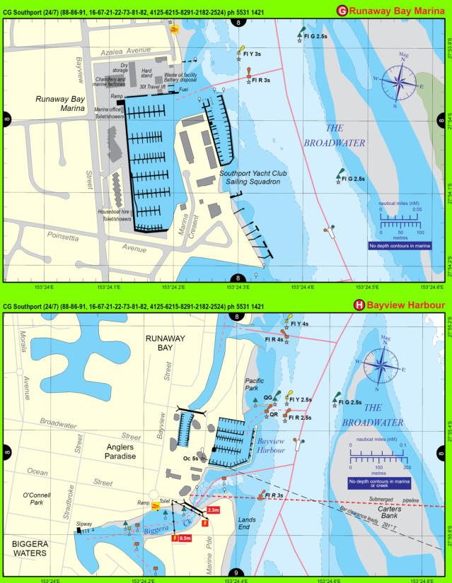
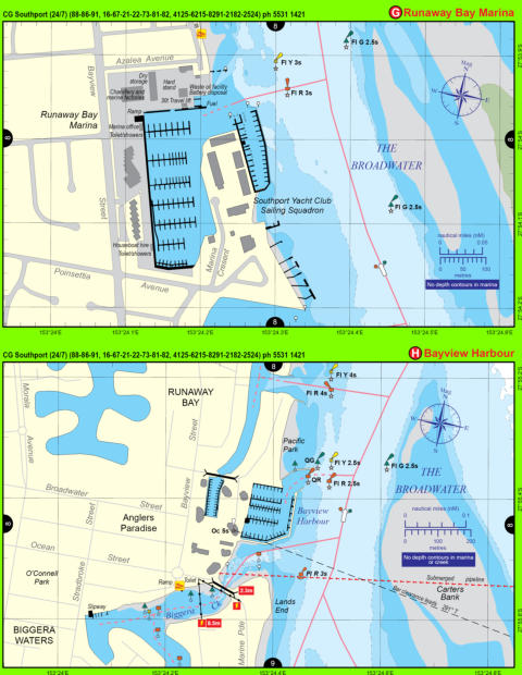
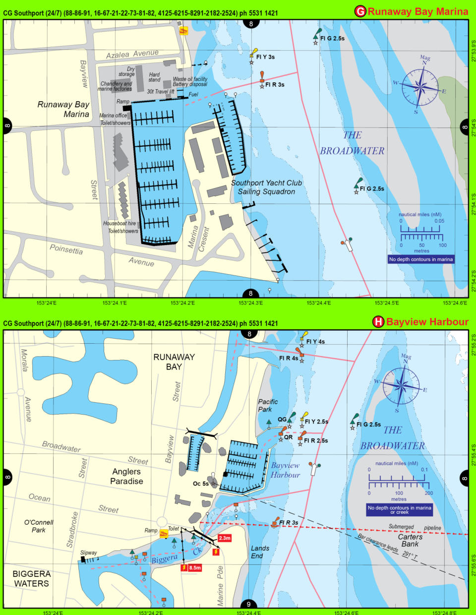
Enlargement G
Enlargement H
Reading the maps
Legend
Navigation information
Map Index
Smooth and partially smooth water limits
Keppel Bay and Port Alma
Gladstone
Seventeen Seventy
Hervey Bay
Maryborough
Northern Moreton Bay
Southern Moreton Bay
Capricorn Coast
Gladstone
Discovery Coast
Hervey Bay
Great Sandy Strait
Noosa River
Sunshine Coast
Pumicestone Passage
Moreton Bay
Southern Moreton Bay
Brisbane River and Bremer River
Northern Gold Coast
Southern Gold Coast
Boating Safety Information
Collision regulations
Navigation lights
Speed limits
Diving operations
Boat wash
Alcohol limits
Lifejackets and personal flotation devices
Distress signals, flares and EPIRBs
Required Safety Gear in Queensland
Boating Safety Stickers
Queensland Boating Capacity Label
Powered Boats with flybridges
Powered vessels 6 metres or more
Powered vessels less than 6 metres
PWC / Jet ski RideSmart Label
Lifejackets sticker (red over white)
Lifejackets sticker (white over red)
First Aid Kit sticker
Fire Extinguisher sticker
Nautical Flags sticker
27MHz Marine Radio Sticker Pack
VHF Marine Radio Sticker Pack
Safety Equipment Sticker Pack
No Smoking sticker
Smoking Area sticker
50:1 Fuel to Oil Ratio sticker
100:1 Fuel to Oil Ratio sticker
Navigation Markers sticker
How to use a VHF marine radio
Volunteer Marine Rescue Organisations
Yeppoon (Rosslyn Bay)
Gladstone
Seventeen Seventy (Round Hill Head)
Bundaberg (Burnett Heads)
Hervey Bay (Urangan)
Wide Bay Bar (Elbow Point)
Noosa Head
Mooloolaba
Caloundra Head
Bribie Island (Bongaree)
Tangalooma Point
Brisbane Bar
Gold Coast Seaway
Tweed Heads
Rain Radars
Gladstone
Gympie (Mt Kanigan)
Brisbane (Mt Stapylton)
Satellite Images
Synoptic Chart
Coastal Waters Forecast
Capricornia Coastal Waters Forecast: St Lawrence to Burnett Heads
Hervey Bay Waters Forecast
Fraser Island Coastal Waters Forecast: Sandy Cape to Double Island Point
Sunshine Coast Waters Forecast: Double Island Point to Cape Moreton
Moreton Bay Forecast
Gold Coast Waters Forecast: Cape Moreton to Point Danger
Current Warnings for Queensland
Round Hill Creek
Wide Bay Bar
Noosa Bar
Maroochy Bar
Mooloolah River mouth
Caloundra Bar
South Passage Bar
Jumpinpin Bar
Gold Coast Seaway
Tallebudgera Bar
Currumbin Bar
Copyright
Acknowledgements
Disclaimer
Terms & Conditions
Sitemap
Advertisers
Contact Us
Navigation information current to 16 June 2014
Map NGC-1
Map NGC-2
Map NGC-3
Map NGC-4
Map NGC-5
Map NGC-6
Map NGC-7
Map NGC-8
Map NGC-9
Map NGC-10
Enlargement A
Enlargement B
Enlargement C
Enlargement D
Enlargement E
Enlargement F
Enlargement G
Enlargement H
Reading the maps
Legend
Navigation information
Map Index
Smooth and partially smooth water limits
Keppel Bay and Port Alma
Gladstone
Seventeen Seventy
Hervey Bay
Maryborough
Northern Moreton Bay
Southern Moreton Bay
Capricorn Coast
Gladstone
Discovery Coast
Hervey Bay
Great Sandy Strait
Noosa River
Sunshine Coast
Pumicestone Passage
Moreton Bay
Southern Moreton Bay
Brisbane River and Bremer River
Northern Gold Coast
Southern Gold Coast
Boating Safety Information
Collision regulations
Navigation lights
Speed limits
Diving operations
Boat wash
Alcohol limits
Lifejackets and personal flotation devices
Distress signals, flares and EPIRBs
Required Safety Gear in Queensland
Boating Safety Stickers
Queensland Boating Capacity Label
Powered Boats with flybridges
Powered vessels 6 metres or more
Powered vessels less than 6 metres
PWC / Jet ski RideSmart Label
Lifejackets sticker (red over white)
Lifejackets sticker (white over red)
First Aid Kit sticker
Fire Extinguisher sticker
Nautical Flags sticker
27MHz Marine Radio Sticker Pack
VHF Marine Radio Sticker Pack
Safety Equipment Sticker Pack
No Smoking sticker
Smoking Area sticker
50:1 Fuel to Oil Ratio sticker
100:1 Fuel to Oil Ratio sticker
Navigation Markers sticker
How to use a VHF marine radio
Volunteer Marine Rescue Organisations
Yeppoon (Rosslyn Bay)
Gladstone
Seventeen Seventy (Round Hill Head)
Bundaberg (Burnett Heads)
Hervey Bay (Urangan)
Wide Bay Bar (Elbow Point)
Noosa Head
Mooloolaba
Caloundra Head
Bribie Island (Bongaree)
Tangalooma Point
Brisbane Bar
Gold Coast Seaway
Tweed Heads
Rain Radars
Gladstone
Gympie (Mt Kanigan)
Brisbane (Mt Stapylton)
Satellite Images
Synoptic Chart
Coastal Waters Forecast
Capricornia Coastal Waters Forecast: St Lawrence to Burnett Heads
Hervey Bay Waters Forecast
Fraser Island Coastal Waters Forecast: Sandy Cape to Double Island Point
Sunshine Coast Waters Forecast: Double Island Point to Cape Moreton
Moreton Bay Forecast
Gold Coast Waters Forecast: Cape Moreton to Point Danger
Current Warnings for Queensland
Round Hill Creek
Wide Bay Bar
Noosa Bar
Maroochy Bar
Mooloolah River mouth
Caloundra Bar
South Passage Bar
Jumpinpin Bar
Gold Coast Seaway
Tallebudgera Bar
Currumbin Bar
Copyright
Acknowledgements
Disclaimer
Terms & Conditions
Advertisers
Contact Us
Navigation information current to 16 June 2014
Map NGC-1
Map NGC-2
Map NGC-3
Map NGC-4
Map NGC-5
Map NGC-6
Map NGC-7
Map NGC-8
Map NGC-9
Map NGC-10
Enlargement A
Enlargement B
Enlargement C
Enlargement D
Enlargement E
Enlargement F
Enlargement G
Enlargement H
HOME
MAPS
MAP LEGEND
WEATHER
RAIN RADAR
GLADSTONE
GYMPIE
BRISBANE
COASTAL WATERS FORECAST
CAPRICORN COAST
HERVEY BAY
FRASER ISLAND
SUNSHINE COAST
MORETON BAY
GOLD COAST
MARINE RESCUE
SHOP
SAFETY STICKERS
RETAILERS